

Rio Rancho, Pomona, CA




Rio Rancho at a Glance
Rio Rancho is ranked #3 of 8 neighborhoods in Pomona with an overall score of 2.9/5. Its standout factor is safety (3.5/5, 2nd of 8 in Pomona). The trade-offs are nearby merchants (1.4/5) and schools (2.6/5).
Rio Rancho Reviews & Questions

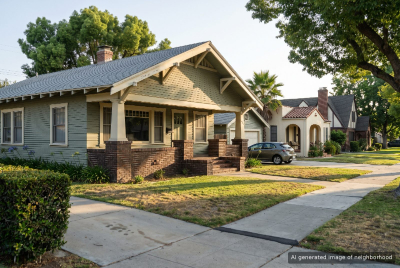
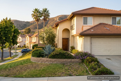
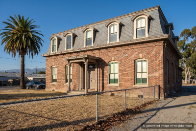
Rio Rancho covers the west side of Pomona where the city meets Cal Poly and the freeways, a patchwork of neighborhoods around Temple Avenue, Mission Boulevard and the old Spadra area. It is more a collection of pockets than one place, and its identity comes from what surrounds it. Kellogg Park and Cesar Chavez Park serve the residential blocks, and Westmont Park on West 9th Street covers the northern end. On the southern slopes, Country Crossing Park and the Eagle Scout Trail off Appian Way give access to the hills that roll toward Phillips Ranch. Housing runs from modest single-family homes on the flatter streets near Mission Boulevard to newer tract homes on the hillside streets in the south. Apartments and condos sit closer to Temple Avenue and the campus. The food scene reflects the area's mix. Seafood City on Surveyor Street is a Filipino supermarket with prepared food counters, and Heartland Organic, a natural foods store on Producer Way, sits nearby. Along West Mission Boulevard, Ardaya's and Kaya Asian Cuisine are neighborhood regulars. Cal Poly Pomona is right next door, and the university Farm Store on University Drive is the place for fruit grown on campus and fresh orange juice. The Rio Rancho Road shopping area to the south in South Pomona has WinCo and more chain restaurants. Freeways are the main tradeoff. The 57, 60 and 10 converge here, which is good for commuting in any direction but means traffic noise on some blocks and long drives around interchanges to reach nearby spots. Still, when the Seafood City lot fills up on a Saturday, Rio Rancho has a busy, lived-in pace.
Top Neighborhoods in Pomona, CA


Rio Rancho Amenities
 Near good merchants
1.4
 Public Spaces
2.9
 Curb Appeal
2.8
Overall Amenities score: 2.6
Rio Rancho Weather
Rio Rancho Photos
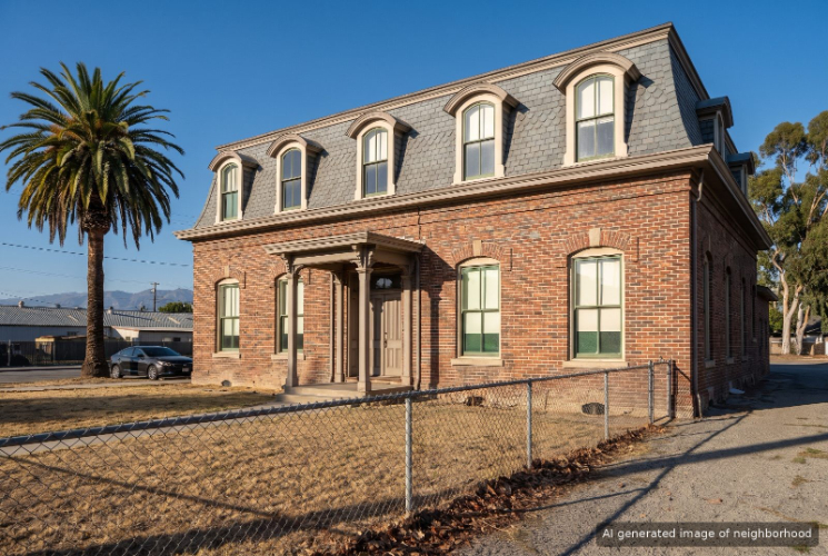
1 of 1
Schools Serving Rio Rancho
| School Name | Type | Grades | Houseberry School Score |
|---|---|---|---|
| Kellogg Polytechnic Elementary | Primary | K-6 | |
| Westmont Elementary | Primary | K-6 | |
| Decker Elementary | Primary | K-6 | |
| Ranch Hills Elementary | Primary | K-6 | |
| Marshall Middle | Middle | 6-8 | |
| Fremont Academy of Engineering and Design | Middle | 7-12 | |
| Lorbeer Middle | Middle | 7-8 | |
| Ganesha High | High | 9-12 | |
| Diamond Ranch High | High | 9-12 |
Click links for school listing
info at GreatSchools.org
Houseberry School Score Data
from CA Dept. of Education
Houseberry recommends using these scores as only a starting point, and conducting your own investigation into what schools fit best for your preferences. School boundaries are not guaranteed and may change. It is important to contact the appropriate school district to confirm enrollment eligibility before making any decision to move to a neighborhood.
Rio Rancho FAQs
8 answers
Is Rio Rancho a good place to live?
Rio Rancho ranks 3rd of 8 neighborhoods in Pomona with an overall Houseberry score of 2.9 out of 5. Its strongest factor is safety (3.5/5). The trade-offs are nearby merchants (1.4/5) and schools (2.6/5).
Is Rio Rancho safe?
Rio Rancho, Pomona scores 3.5 out of 5 on Houseberry's Safety Score, ranking 2nd of 8 neighborhoods in Pomona.
Which schools serve Rio Rancho?
Schools serving Rio Rancho, Pomona include Kellogg Polytechnic Elementary (1.7/5), Westmont Elementary (2.4/5), Decker Elementary (2.5/5), Ranch Hills Elementary (3.2/5) and Marshall Middle (2.8/5). 4 more schools are listed in the Schools section on this page.
What is the weather like in Rio Rancho?
Rio Rancho, Pomona receives 80% of its possible sunshine, 7th of 8 in Pomona. Summer days run 61° to 87°F and winter days 45° to 67°F, August is the warmest month and rainfall averages about 16 inches a year.
Is Rio Rancho walkable to shops and restaurants?
Rio Rancho, Pomona scores 1.4 out of 5 for nearby merchants and 2.9 out of 5 for public spaces. Its overall amenities score is 2.6 out of 5, 7th of 8 in Pomona.
What is Rio Rancho known for?
Rio Rancho, Pomona is associated with Seafood City, Spadra Cemetery and Kellogg Park.
How does Rio Rancho compare to other Pomona neighborhoods?
Rio Rancho ranks 3rd of 8 neighborhoods in Pomona. It ranks 2nd of 8 in Pomona for safety (3.5/5) and scores lowest on nearby merchants (1.4/5). The next-ranked neighborhoods in Pomona are South Pomona and Ganesha.
What are the downsides of living in Rio Rancho?
Rio Rancho, Pomona scores lowest on nearby merchants (1.4/5) and schools (2.6/5).
1 of 1
Rio Rancho Map
View Full Map
All information provided on this website including but not limited to - school ratings, safety, amenities, user opinions, and property data - is for general informational purposes only. We do not guarantee its reliability, accuracy, or completeness. Users should independently verify information and consult appropriate professionals as needed. By using this website, you agree Houseberry is not responsible for actions, decisions, or consequences arising from reliance on the information provided
houseberry.com - CA DRE# 01847391
 Bay East ©2025. CCAR ©2025. bridgeMLS ©2025. Information Deemed Reliable But Not Guaranteed. This information is being provided by the Bay East MLS, or CCAR MLS, or bridgeMLS. The listings presented here may or may not be listed by the Broker/Agent operating this website. This information is intended for the personal use of consumers and may not be used for any purpose other than to identify prospective properties consumers may be interested in purchasing. Data last updated at October 29, 2026 12:00 AM