Plan Bay Area 2050+: Where the Region Will Grow
The Bay Area's official long-range blueprint, Plan Bay Area 2050+, was adopted this spring. Here is what its 35 strategies actually steer, in plain English, and what it means for your neighborhood.

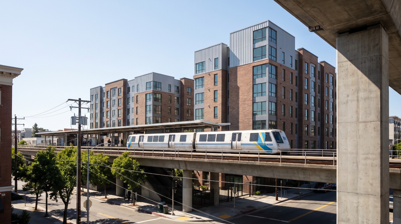
A BART train arriving at an East Bay station ringed by new mid-rise housing, the kind of transit-oriented growth Plan Bay Area 2050+ steers. Photo: Houseberry
Every few years, two regional agencies most Bay Area residents have never heard of sit down and decide, on paper, where the next few million people are supposed to live and how they will get around. The newest version of that document, Plan Bay Area 2050+, was adopted this spring. It runs on 35 strategies and a small mountain of acronyms. Strip the jargon away and it is a map of where the region intends to put homes, transit, and money over the next 25 years, which makes it worth understanding even if you never sit through a single hearing.
What Plan Bay Area 2050+ actually is
Two agencies wrote it jointly: the Metropolitan Transportation Commission, which plans and funds transportation for the nine-county Bay Area, and the Association of Bay Area Governments, the region's council of 101 cities and nine counties. ABAG's executive board adopted the final plan in March 2026 and MTC followed days later, certifying the environmental report and capping a nearly three-year process that drew input from more than 17,600 residents and organizations.
It exists because state law requires it. Under a 2008 climate law, every large California region has to write a long-range plan that links housing and transportation in a way that cuts driving emissions. So Plan Bay Area is not optional, and it is not a wish list. It is the framework cities are expected to plan against. What it is not is a zoning code. It does not approve a single building or rezone your block by itself. It steers, through where the region points its transportation dollars and its housing programs, and through the growth assumptions every city inherits.
Where it points growth
The core idea has not changed since the first Plan Bay Area, and it is the same logic driving the state's newer transit laws: put new homes and jobs in compact, mixed-use places near transit rather than spreading them across the region's edges. The plan concentrates expected growth in locally nominated infill zones near rail and frequent bus service, called Priority Development Areas, and steers housing and transportation money toward them. In parallel, it protects open space and farmland through Priority Conservation Areas. If your neighborhood is one of those transit-served growth zones, the plan assumes more homes land there. If it is a conservation area or simply far from transit, it assumes fewer.
The 2026 update leans on a handful of priorities worth knowing in plain terms:
- More housing near transit, plus funding aimed at building and preserving affordable units so the region stops pricing people out.
- A first-of-its-kind companion plan, Transit 2050+, built with the region's transit agencies to keep Bay Area transit running and make it faster, more frequent, and more reliable.
- Resilience investments against sea level rise and wildfire, the two hazards most likely to reshape where building is even possible.
- Money steered toward Equity Priority Communities, so service improvements reach the neighborhoods that depend on transit most.
Why a regional plan matters to one neighborhood
It is easy to file a document like this under distant bureaucracy. That is a mistake for anyone making a housing decision. The plan does not rezone your street, but it signals, years ahead, where the region intends to concentrate homes, transit service, and investment. A neighborhood ringed around a BART or Caltrain stop and flagged as a growth area should expect steady density pressure and, ideally, better transit to go with it. The way we look at it when we compare neighborhoods, that is a slow-moving but real input, sitting alongside schools, safety, and amenities rather than replacing them. If you want to see how that plays out today, how East Bay neighborhoods rank and how San Jose neighborhoods rank are a useful ground-level companion to the regional map.
There is an honest tension in the plan, and it is worth naming. It bets heavily on transit that is still climbing back from the pandemic. Transit-oriented growth only makes sense if the trains and buses actually show up more often, which is exactly what the Transit 2050+ piece is trying to fund. If those service improvements stall, the case for concentrating homes near stations gets harder to make. We have written about that recovery from the rider's side in our look at BART's new fare gates and the station neighborhoods around them, and about the state rules pushing homes toward transit in our piece on the latest Bay Area housing bill.
What to watch next
A blueprint only matters if the region funds and follows it. The action moves now to implementation, the grant programs that pay for transit-oriented projects, the next round of state housing targets handed to each city, the rollout of new transit-density rules, and whether the money behind Transit 2050+ actually materializes. The single most useful thing a resident can do is find out whether their own neighborhood sits inside a Priority Development Area and whether their city has a station-area plan in the works. That is where a 25-year regional vision turns into the building going up two blocks over.
Sources
MTC: MTC, ABAG adopt final Plan Bay Area 2050+ and Environmental Impact Report
The Houseberry Research Team is Houseberry's reporting team: Bay Area real estate analysts, data specialists and longtime local market watchers. Every day we check the public record: building permits, city council and planning agendas, county recorder filings, state housing bills, police incident data and school results. Then we tie each story to what it means for specific neighborhoods, using Houseberry's own neighborhood data on prices, appreciation, safety, schools and amenities. Questions or corrections: Contact us.
All information provided on this website including but not limited to - school ratings, safety, amenities, user opinions, and property data - is for general informational purposes only. We do not guarantee its reliability, accuracy, or completeness. Users should independently verify information and consult appropriate professionals as needed. By using this website, you agree Houseberry is not responsible for actions, decisions, or consequences arising from reliance on the information provided
houseberry.com - CA DRE# 01847391
 Bay East ©2025. CCAR ©2025. bridgeMLS ©2025. Information Deemed Reliable But Not Guaranteed. This information is being provided by the Bay East MLS, or CCAR MLS, or bridgeMLS. The listings presented here may or may not be listed by the Broker/Agent operating this website. This information is intended for the personal use of consumers and may not be used for any purpose other than to identify prospective properties consumers may be interested in purchasing. Data last updated at October 13, 2026 12:00 AM