

Hastings Ranch, Pasadena, CA





Hastings Ranch at a Glance
Hastings Ranch is ranked #7 of 24 neighborhoods in Pasadena with an overall score of 3.4/5. Its standout factors are safety (3.9/5, 9th of 24 in Pasadena) and curb appeal (3.7/5). The trade-offs are nearby merchants (2.6/5) and schools (3.2/5).
Hastings Ranch Reviews & Questions

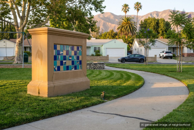
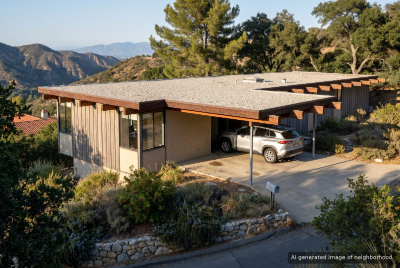
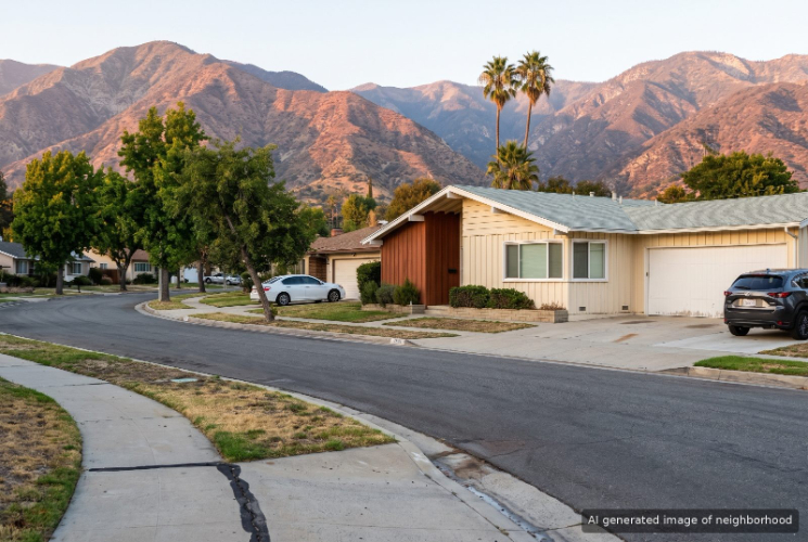
Hastings Ranch is the postwar ranch-house corner of Pasadena, laid out on the old Hastings family ranch at the foot of the San Gabriel Mountains on the city's east side. Architect Edward Fickett designed its three tracts around 1950, and Sierra Madre Boulevard still divides the upper and lower sections. Hastings Ranch houses are single-story ranches on generous lots, many with attached garages, flat driveways and backyards with room for a pool. The upper tract was hit hard in the January 2025 Eaton Fire, which destroyed about 80 homes there, so cleared lots and new construction now sit between the original midcentury houses. Every December the upper streets light up for a holiday display that has run for more than seven decades. Valley Lights Drive puts out its handmade angels, and after the fire residents marked each lost home with a bright star. Hamilton Park on Cartwright Street is the neighborhood's own green space. Shopping is the easy part. The shopping center on Foothill Boulevard opened in 1960 and now has a Whole Foods, a Ralphs and a Peet's Coffee, with Trader Joe's around the corner on Rosemead Boulevard. Poster's Donuts covers the early-morning run. This is a driving neighborhood. Errands run along Foothill, Rosemead and Michillinda, and the last Metro A Line stop, at Sierra Madre Villa, gives a rail option toward Old Pasadena and downtown Los Angeles. The tradeoff is dependence on the car, and in Upper Hastings Ranch the fire recovery means active construction on some streets for a while yet. On a December night the angels and the stars share the same blocks, and a drive down Valley Lights shows both the old tradition and the rebuilding in one pass.
Top Neighborhoods in Pasadena, CA


Hastings Ranch Amenities
 Near good merchants
2.6
 Public Spaces
3.5
 Curb Appeal
3.7
Overall Amenities score: 3.4
Hastings Ranch Weather
Hastings Ranch Photos
1 of 1
Schools Serving Hastings Ranch
| School Name | Type | Grades | Houseberry School Score |
|---|---|---|---|
| Norma Coombs Elementary | Primary | K-5 | |
| Don Benito Fundamental | Primary | K-5 | |
| Field (Eugene) Elementary | Primary | K-5 | |
| Willard Elementary | Primary | K-5 | |
| Pasadena High | High | 9-12 |
Click links for school listing
info at GreatSchools.org
Houseberry School Score Data
from CA Dept. of Education
Houseberry recommends using these scores as only a starting point, and conducting your own investigation into what schools fit best for your preferences. School boundaries are not guaranteed and may change. It is important to contact the appropriate school district to confirm enrollment eligibility before making any decision to move to a neighborhood.
Hastings Ranch FAQs
8 answers
Is Hastings Ranch a good place to live?
Hastings Ranch ranks 7th of 24 neighborhoods in Pasadena with an overall Houseberry score of 3.4 out of 5. Its strongest factors are safety (3.9/5) and curb appeal (3.7/5). The trade-offs are nearby merchants (2.6/5) and schools (3.2/5).
Is Hastings Ranch safe?
Hastings Ranch, Pasadena scores 3.9 out of 5 on Houseberry's Safety Score, ranking 9th of 24 neighborhoods in Pasadena.
Which schools serve Hastings Ranch?
Schools serving Hastings Ranch, Pasadena include Norma Coombs Elementary (2.7/5), Don Benito Fundamental (3.0/5), Field (Eugene) Elementary (4.7/5), Willard Elementary (3.0/5) and Pasadena High (3.4/5).
What is the weather like in Hastings Ranch?
Hastings Ranch, Pasadena receives 79% of its possible sunshine, 22nd of 24 in Pasadena. Summer days run 61° to 87°F and winter days 46° to 67°F, August is the warmest month and rainfall averages about 20 inches a year.
Is Hastings Ranch walkable to shops and restaurants?
Hastings Ranch, Pasadena scores 2.6 out of 5 for nearby merchants and 3.5 out of 5 for public spaces. Its overall amenities score is 3.4 out of 5, 15th of 24 in Pasadena.
What is Hastings Ranch known for?
Hastings Ranch, Pasadena is associated with Holiday Lights, Panda Inn and Fickett Ranch Homes.
How does Hastings Ranch compare to other Pasadena neighborhoods?
Hastings Ranch ranks 7th of 24 neighborhoods in Pasadena. It ranks 9th of 24 in Pasadena for safety (3.9/5) and scores lowest on nearby merchants (2.6/5). The next-ranked neighborhoods in Pasadena are North Pasadena Heights and Sierra Madre Villa.
What are the downsides of living in Hastings Ranch?
Hastings Ranch, Pasadena scores lowest on nearby merchants (2.6/5) and schools (3.2/5).
1 of 1
Hastings Ranch Map
View Full Map
All information provided on this website including but not limited to - school ratings, safety, amenities, user opinions, and property data - is for general informational purposes only. We do not guarantee its reliability, accuracy, or completeness. Users should independently verify information and consult appropriate professionals as needed. By using this website, you agree Houseberry is not responsible for actions, decisions, or consequences arising from reliance on the information provided
houseberry.com - CA DRE# 01847391
 Bay East ©2025. CCAR ©2025. bridgeMLS ©2025. Information Deemed Reliable But Not Guaranteed. This information is being provided by the Bay East MLS, or CCAR MLS, or bridgeMLS. The listings presented here may or may not be listed by the Broker/Agent operating this website. This information is intended for the personal use of consumers and may not be used for any purpose other than to identify prospective properties consumers may be interested in purchasing. Data last updated at October 29, 2026 12:00 AM