San Francisco's calmest trick-or-treat blocks aren't famous ones
Daytime merchant crawls for toddlers, quiet residential blocks like Westwood Park and Sunnyside, and the closed streets that are easier than Belvedere, with 2026 times and Houseberry safety scores.

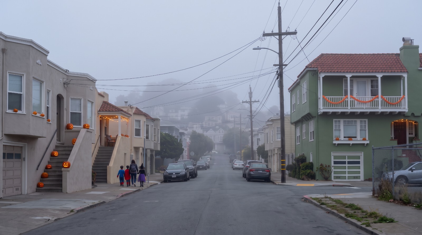
AI-rendered view of Hearst Avenue in Sunnyside, San Francisco, on Halloween afternoon under the marine layer, with jack-o'-lanterns on the stoops and small trick-or-treaters on the sidewalk Photo: Houseberry
About 5,000 people walked Belvedere Street in Cole Valley last Halloween, KRON4 reported. That is a great night for a nine-year-old in a homemade costume. For a two-year-old in a pumpkin suit, it is a wall of knees.
San Francisco has plenty of calmer options, and this year the calendar helps. Halloween falls on Saturday, Oct. 31, so merchant trick-or-treats on West Portal Avenue, Balboa Street and Ocean Avenue run in daylight. This guide sorts the city by the age of the kid, and leans on Houseberry's neighborhood scores to find the quiet residential blocks that never make the famous lists.
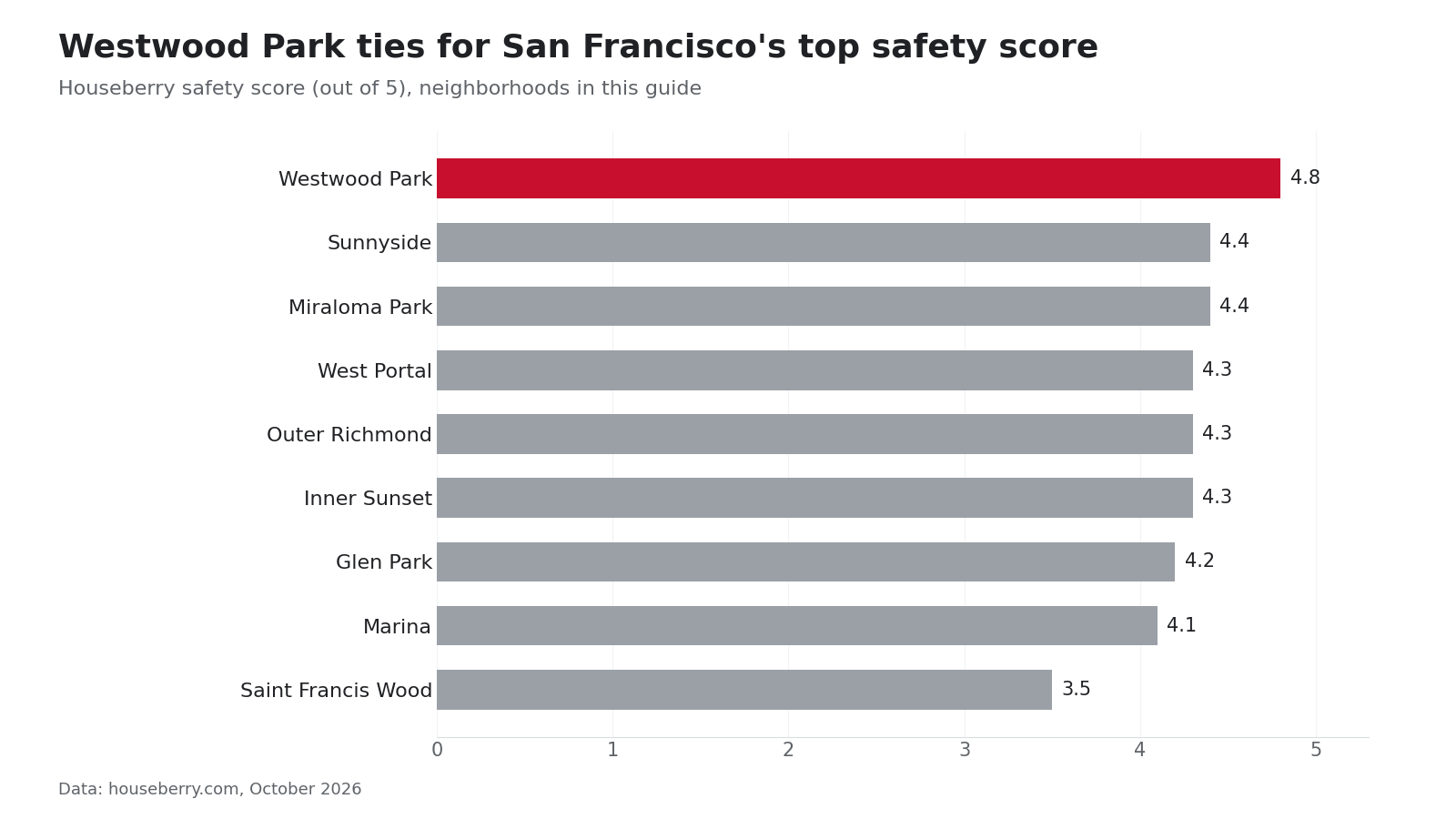
The data has a surprise. The two San Francisco neighborhoods tied for the highest safety score on Houseberry, Westwood Park and Sherwood Forest, did not have a single street on the city's 2025 list of car-free Halloween blocks.
Toddlers: go in daylight
A daytime merchant crawl is the easiest Halloween a small kid can have. The shops are at stroller height, the sidewalks are flat, and nobody is out after dark. Five are on the calendar for 2026:
| Event | Date and time | Where |
|---|---|---|
| Inner Sunset Trick or Treat and Fall Fest | Sun., Oct. 25, 10 a.m. to noon | Starts at the Inner Sunset Farmers' Market, 8th Avenue entrance |
| The Great Hauntway | Sun., Oct. 25, 1 to 4 p.m. | Sunset Dunes, Judah to Taraval |
| Balboa Street Fright Fest | Sat., Oct. 31, 11 a.m. to 4 p.m. | Balboa Street, 33rd to 41st avenues |
| Ocean Avenue Halloween Block Party | Sat., Oct. 31, noon to 3 p.m. | Unity Plaza, 1002 to 1040 Ocean Ave. |
| West Portal Halloween Stroll | Sat., Oct. 31, 4 to 7 p.m. | West Portal Avenue, costume contest at 5 p.m. |
The Hauntway, on the car-free stretch of the old Great Highway, is the one built with small kids in mind. Its organizers list a sensory-friendly quiet station near Pacheco Street and teal-pumpkin treats for kids with food allergies. The West Portal stroll is confirmed on the merchants' own calendar. West Portal scores 4.3 on safety in Houseberry's data, and the K, L and M all stop at West Portal Station.
Balboa Street's Fright Fest is in its 12th year, according to its listing, run by the Balboa Village Merchants Association. The Outer Richmond also scores 4.3 on safety, and the avenues on either side of Balboa are flat for blocks.
Two quiet blocks the famous lists skip
Westwood Park, after the Ocean Avenue party
Westwood Park is about 650 bungalows on curving, nearly level streets just north of Ocean Avenue, built in the 1910s and 1920s. It is a short walk from the Unity Plaza block party, and it is the calmest high-density trick-or-treat terrain we found in the city.
Nobody calls it a Halloween destination, and that is the point. We picked it from the layout and the data, not from a famous street. Westwood Park ties for the best safety score in San Francisco at 4.8 out of 5, and Houseberry's price history puts the typical home there at about $2.18 million in September 2026. Next door, Saint Francis Wood closes Terrace Drive every year and draws the crowd. Its safety score is 3.5.
Go after the party ends at 3, while it is still light. The trade-off: some houses here will not be decorated, and you will see more kids from the block than kids from across town.
Sunnyside's Slow Hearst
Hearst Avenue in Sunnyside is a city Slow Street, built for low traffic all year. On Halloween the neighbors throw a party at Hearst and Detroit Street from 3 to 6 p.m., with an allergy-labeled potluck and a treat map, according to the Slow Hearst site. Last year Hearst between Edna and Congo streets was closed to cars from 4 to 8.
The SF Standard described Sunnyside's Halloween in 2023 as not crowded, with many neighborhood kids and a suburban feel. Sunnyside scores 4.4 on safety in Houseberry's data, and the typical home there ran about $1.64 million in September 2026. The 23, 36 and 43 buses all stop nearby.
School-age kids: the closed streets nobody lists
Once a kid can walk 20 blocks and wants decorations, look for car-free streets. These were on Mission Local's 2025 list and are easier than Belvedere:
- Randall Street in Fairmount, Harper to Whitney, 4 to 10 p.m.
- Waller Street in Duboce Triangle, Steiner to Scott, 5 to 9 p.m. Local News Matters found ghosts in the windows and a giant sandworm in the garden beds there last year.
- Avila Street in the Marina, Chestnut to Prado, 4 to 9 p.m. Dead flat.
- 12th Avenue in the Inner Sunset, Irving to Lincoln, 3 to 9 p.m. One 2026 guide reports this year's closure moves to Judah to Kirkham, which we could not confirm.
Glen Park has already confirmed its 2026 plans. Haunted Chenery runs 5 to 9 p.m., with Chenery closed from 5 to 8:30, the Glen Park Association posted on Oct. 14. Glen Park scores 4.2 on safety, and BART is a block away.
Up the hill, Miraloma Park gets steady traffic around Rockdale Drive and Chaves Avenue. A local parents' guide suggests Juanita Way near Chaves as the less crowded option. It scores 4.4 on safety.
The famous blocks, briefly
Belvedere, Fair Oaks Street, Sea Cliff, Jordan Park's Commonwealth Avenue and Bernal's Cortland Avenue are the big scenes. We covered each of them street by street in our Bay Area trick-or-treat guide. With small kids, go before 5 or go somewhere else.
Questions parents ask
What time should we start? For toddlers, 3 to 5 p.m. For older kids, 5 to 7:30, when the closed streets are full and the light is going.
Which streets are closed in 2026? The full list usually comes out in the last week of October. Organizers pay SFMTA $56 for one block, and only residents and emergency vehicles get through the barricades.
Should we drive? Not to the famous blocks. Parking near Belvedere and Sea Cliff is close to impossible. Muni is free for anyone 18 and under.
What if it rains? The Ocean Avenue and Balboa Street events are outdoors. Check the forecast around Oct. 28 and keep an indoor backup like a library or museum event.
Our pick for a first Halloween
Do the Ocean Avenue party at noon, walk into Westwood Park around 2, and be home before the streetlights come on. For a kid old enough to want a scene, take BART to Glen Park or the 36 to Sunnyside and stay until 7.
Every neighborhood in this guide is scored side by side on Houseberry's San Francisco safety rankings, and the overall rankings show how those blocks stack up the rest of the year.
Sources
- KRON4, Belvedere Street Halloween tradition, Oct. 31, 2025
- Mission Local, "Here's every car-free street in S.F. for Halloween this year," Oct. 30, 2025
- SFMTA, trick-or-treat street closure program and Free Muni for Youth
- Glen Park Association, "Halloween 2026," Oct. 14, 2026
- West Portal merchants events calendar, Slow Hearst, Sunset Dunes Hauntway and Inner Sunset Merchants pages, checked Oct. 21, 2026
- Funcheap SF listings for Balboa Street Fright Fest and Ocean Avenue Block Party, 2026
- SF Standard trick-or-treating guide, Sept. 11, 2023
- Local News Matters, decorated homes, Oct. 27, 2025
- WeatherSpark, San Francisco October averages
- Houseberry neighborhood scores and price history, October 2026
The Houseberry Research Team is Houseberry's reporting team: Bay Area real estate analysts, data specialists and longtime local market watchers. Every day we check the public record: building permits, city council and planning agendas, county recorder filings, state housing bills, police incident data and school results. Then we tie each story to what it means for specific neighborhoods, using Houseberry's own neighborhood data on prices, appreciation, safety, schools and amenities. Questions or corrections: Contact us.
Map of San Francisco Neighborhoods
Loading map...
View Full Map
Top Neighborhoods in San Francisco, CA





All information provided on this website including but not limited to - school ratings, safety, amenities, user opinions, and property data - is for general informational purposes only. We do not guarantee its reliability, accuracy, or completeness. Users should independently verify information and consult appropriate professionals as needed. By using this website, you agree Houseberry is not responsible for actions, decisions, or consequences arising from reliance on the information provided
houseberry.com - CA DRE# 01847391
 Bay East ©2025. CCAR ©2025. bridgeMLS ©2025. Information Deemed Reliable But Not Guaranteed. This information is being provided by the Bay East MLS, or CCAR MLS, or bridgeMLS. The listings presented here may or may not be listed by the Broker/Agent operating this website. This information is intended for the personal use of consumers and may not be used for any purpose other than to identify prospective properties consumers may be interested in purchasing. Data last updated at October 22, 2026 12:00 AM