Super El Niño Winter: How Bay Area Buyers Check Flood Risk
A near-record El Niño is stacking on the highest sea levels ever measured here. How to check any Bay Area home's flood exposure before you write an offer, in about an hour.

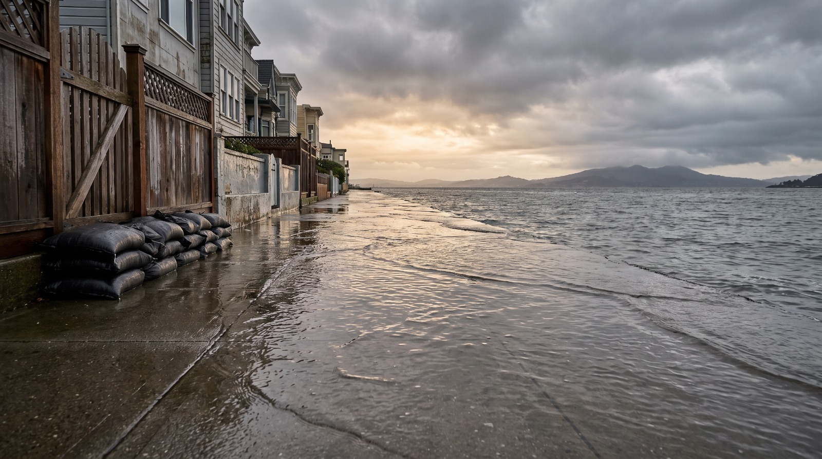
King tide water spilling over a bayfront path beside Bay Area homes, the flood risk picture buyers should check before an El Nino winter Photo: Houseberry
Every winter there is a morning when the Manzanita park-and-ride at the foot of Mill Valley simply is not there, a king tide sitting where the parking spaces were, commuters idling on the shoulder of Highway 101 waiting for the Bay to give the asphalt back. It happens on the sunniest days of December, no storm required. This winter, forecasters expect that water to start from the highest baseline ever measured on this coast, and if you are shopping for a home anywhere near the shoreline, the next hour of reading is worth more than any open house.
The short version: the ocean is arriving higher this winter whether or not the rain does, the risk is intensely block-by-block rather than city-by-city, and about an hour of homework tells you exactly where any specific house stands.
What the forecasters are actually saying
The El Niño building in the Pacific is genuinely unusual. By early August the key ocean index sat about 1.5 degrees Celsius above average, with a 90 percent chance of crossing the 2.0 threshold by late fall and a 69 percent chance of ranking as the strongest event since 1950, per Bay Nature’s roundup of the forecasts. Climate scientist Daniel Swain told KQED that people who think about coastal risk are openly concerned this winter produces the highest sea levels California has recorded.
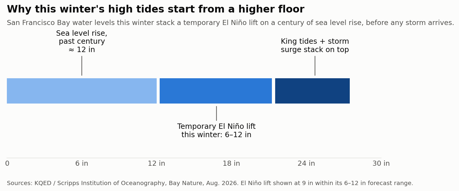
Notice what that forecast does not say. It does not promise a wet winter. The Bay Area sits in the zone with equal chances of a wetter or drier season, and the famous 2015 Godzilla El Niño delivered a dry one. What the warm ocean does reliably is stand the water up higher: El Niño has already added about half a foot to local sea levels, on its way to a temporary lift of 6 to 12 inches, stacked on the roughly one foot the Bay has risen over the past century. NOAA’s own coastal outlook flags this exact double-up of El Niño and high-tide flooding.
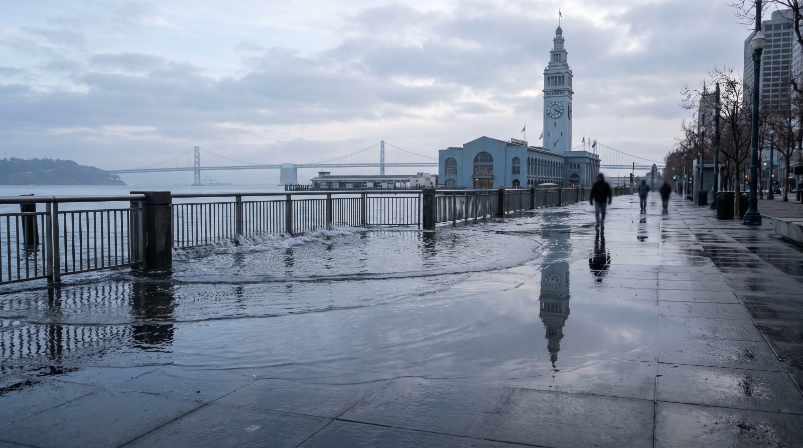
The dates worth circling are the king tides, the handful of highest astronomical tides in November, December, and January. Those mornings are when the Embarcadero seawall gets overtopped for an hour and low corners of the shoreline quietly pond. This year they arrive on stilts.
Shoreline risk is a block-by-block fact, not a city label
Here is the thing that surprises people moving here: flood exposure in the Bay Area almost never follows city lines. KQED’s reporting lists the usual suspects for this winter, the Embarcadero, low stretches of Highways 1 and 101, Manzanita in Marin, and the low corners around San Francisco, San Pablo, and Monterey Bays. But two houses six blocks apart can carry completely different risk, because six blocks can mean twelve feet of elevation.
Foster City is the cleanest example of the paradox. It was built on engineered fill behind a levee system, it is threaded with lagoons, and it is one of the most expensive family markets on the Peninsula, with a median around $2.15 million in July 2026 and a 4.3 school score in our data. Alameda, an island, has a median around $1.4 million and some of the East Bay’s most contented homeowners. Hundreds of thousands of Bay Area families live happily below the king-tide line behind levees, pumps, and seawalls. The point of checking is not to avoid these places. It is to know which infrastructure your mortgage depends on, and what it costs to stand behind it.
The hour of homework that settles it
When a family asks me how to think about a specific shoreline house, this is the sequence, and it genuinely takes about an hour.
Look the address up on the FEMA map. The Flood Map Service Center is free and takes a minute per address. If the parcel sits in a Special Flood Hazard Area, a zone starting with A or V, a federally backed lender will require flood insurance on top of your homeowners policy. That single fact changes the monthly math, so learn it before you fall in love.
Read the disclosure early, not at signing. California sellers must hand over a Natural Hazard Disclosure that states whether the home sits in a flood hazard zone. It is legally required paperwork that most buyers first see inside a 200-page disclosure packet at 11 pm. Ask the listing agent for it the day you get serious.
Price the insurance before the offer. Flood coverage is a separate policy, typically through the National Flood Insurance Program or a private carrier, and standard homeowners insurance does not cover rising water. Between fire maps and flood zones, coverage is now a first-week question in this region, something we walked through in our piece on Bay Area insurance spreading past the hills.
Visit on a king tide. The tide tables are public, the November through January peak mornings are known in advance, and no document beats standing on the street watching where the water actually goes. Check the storm drains at the low corner. Ask a neighbor what January looked like in 2023.
Ask the city one question: who maintains the levee or seawall, and when was it last certified? Foster City has spent years and real money raising its levees. Other shorelines lean on infrastructure with no funded plan. Same map color, very different answer.
How to hold all this without panic
A flood zone is not a verdict on a neighborhood, it is a cost and a set of questions, and plenty of the region’s best places to raise kids sit behind good engineering. What this winter changes is the price of not asking. A super El Niño on top of record baseline seas means the shoreline gets a preview of what an ordinary decade-from-now winter looks like, and houses will be bought and sold this spring by people who watched the same king tide from very different states of knowledge.
Be the buyer who already knew. The hour of homework is free, the king tides are on a schedule, and the neighborhoods that handle water well have long records of proving it. That record, not the weather, is what you are really buying.
Sources
KQED: California could see the highest sea levels on record this year thanks to El Nino
Bay Nature: A super El Nino is here
NOAA Ocean Service: El Nino and high tide flooding, a possible double whammy for coastal communities
The Houseberry Research Team is Houseberry's reporting team: Bay Area real estate analysts, data specialists and longtime local market watchers. Every day we check the public record: building permits, city council and planning agendas, county recorder filings, state housing bills, police incident data and school results. Then we tie each story to what it means for specific neighborhoods, using Houseberry's own neighborhood data on prices, appreciation, safety, schools and amenities. Questions or corrections: Contact us.
All information provided on this website including but not limited to - school ratings, safety, amenities, user opinions, and property data - is for general informational purposes only. We do not guarantee its reliability, accuracy, or completeness. Users should independently verify information and consult appropriate professionals as needed. By using this website, you agree Houseberry is not responsible for actions, decisions, or consequences arising from reliance on the information provided
houseberry.com - CA DRE# 01847391
 Bay East ©2025. CCAR ©2025. bridgeMLS ©2025. Information Deemed Reliable But Not Guaranteed. This information is being provided by the Bay East MLS, or CCAR MLS, or bridgeMLS. The listings presented here may or may not be listed by the Broker/Agent operating this website. This information is intended for the personal use of consumers and may not be used for any purpose other than to identify prospective properties consumers may be interested in purchasing. Data last updated at October 3, 2026 12:00 AM