Monterey's king tides hit 6.9 feet the day before Thanksgiving
Monterey's highest tides of the season peak at 6.86 feet on Nov. 25, with minus tides each afternoon. Here are the times, where the water shows up on the peninsula, and the best tide-pool day.

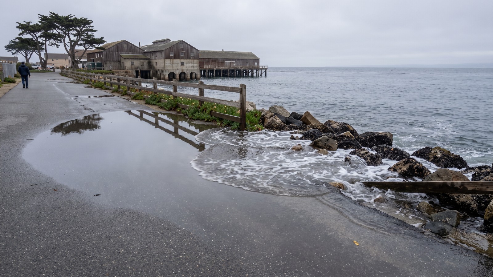
AI-generated view of a king tide washing against the rocks beside the Coastal Recreation Trail near Cannery Row in Monterey Photo: Houseberry
The highest tide of the week in Monterey arrives at 9:39 a.m. on Wednesday, Nov. 25, the day before Thanksgiving, at 6.86 feet, according to NOAA's predictions for the Monterey harbor gauge. Eight hours later the same water drops to 1.5 feet below the zero line. That swing of more than 8 feet is a king tide.
The California King Tides Project lists Nov. 24 to 26 as the first statewide king-tide window of the season, followed by Dec. 23 to 25 and Jan. 21 and 22, 2027. Mornings bring the high water to the Cannery Row seawall and the Del Monte Beach dunes. Late afternoons bring the low water that opens up the tide pools in Pacific Grove.
We covered the Bay Area's dates in our Bay Area king tides guide. This is the Monterey Peninsula version: when to go, where the water shows up, and what Houseberry's numbers say about the neighborhoods closest to it.
Here is the full week at the Monterey harbor gauge.
| Day | High tide | Height | Low tide | Height |
|---|---|---|---|---|
| Mon., Nov. 23 | 8:17 a.m. | 6.50 ft | 3:41 p.m. | minus 0.95 ft |
| Tue., Nov. 24 | 8:56 a.m. | 6.76 ft | 4:28 p.m. | minus 1.34 ft |
| Wed., Nov. 25 | 9:39 a.m. | 6.86 ft | 5:18 p.m. | minus 1.53 ft |
| Thu., Nov. 26 | 10:26 a.m. | 6.77 ft | 6:09 p.m. | minus 1.52 ft |
| Fri., Nov. 27 | 11:17 a.m. | 6.46 ft | 7:02 p.m. | minus 1.32 ft |
Heights are in feet above or below mean lower low water at NOAA station 9413450 in Monterey Harbor. Wind and swell can push the actual water higher than the prediction.
Where to watch the high water
San Carlos Beach and the Coastal Recreation Trail. Where the paved trail hugs the shore by the Coast Guard Pier at the start of Cannery Row, a king tide morning puts the water against the rocks right below the path and swallows most of the little beach. Go between 9 and 10:30 a.m. Wednesday.
Del Monte Beach. The dunes east of Wharf No. 2 narrow to a strip at high water. The neighborhood behind them, Del Monte Beach, scores 4.1 out of 5 on safety and 3.6 overall on Houseberry, and its typical price rose about 3 percent over the past year. It is one of Monterey's most expensive neighborhoods, second to Alta Mesa among those with neighborhood-level price data.
Fisherman's Wharf and the harbor. The tide gauge that sets these numbers sits in the harbor, so this is where the predictions line up best with what you see. Watch the water climb the pilings from the wharf.
Where to go at low tide
The afternoon lows are the reward for the week. Point Pinos, Asilomar and the rocks around Lovers Point in Pacific Grove open up with sea stars, anemones and kelp beds that are underwater most of the year. Tuesday's minus 1.34 feet at 4:28 p.m. is the one to plan around, because Wednesday's low comes at dusk and Thursday's after dark. Step on bare rock, not on the animals, and keep an eye on the incoming water.
Pacific Grove scores well on Houseberry's numbers too. Its Downtown neighborhood rates 4.4 out of 5 overall, the top of the city's 13 ranked neighborhoods.
King tides are a preview. A 6.9-foot morning tide today is close to what an ordinary high tide may look like on this coast after a foot or two of sea-level rise, which is why the state collects photos of them.
We think anyone buying near the water in Monterey, Seaside or Marina should walk the property at a king tide before closing. It costs nothing and it shows what the disclosure packet cannot. Compare the peninsula's neighborhoods side by side on the Monterey rankings, then check the block on the Houseberry map before you schedule the walk.
Sources
- Tide predictions, Monterey station 9413450, NOAA
- California King Tides Project, California Coastal Commission
- California King Tides dates for Santa Cruz County, Visit Santa Cruz County
The Houseberry Research Team is Houseberry's reporting team: Bay Area real estate analysts, data specialists and longtime local market watchers. Every day we check the public record: building permits, city council and planning agendas, county recorder filings, state housing bills, police incident data and school results. Then we tie each story to what it means for specific neighborhoods, using Houseberry's own neighborhood data on prices, appreciation, safety, schools and amenities. Questions or corrections: Contact us.
Map of Monterey Neighborhoods
Loading map...
View Full Map
Top Neighborhoods in Monterey, CA



All information provided on this website including but not limited to - school ratings, safety, amenities, user opinions, and property data - is for general informational purposes only. We do not guarantee its reliability, accuracy, or completeness. Users should independently verify information and consult appropriate professionals as needed. By using this website, you agree Houseberry is not responsible for actions, decisions, or consequences arising from reliance on the information provided
houseberry.com - CA DRE# 01847391
 Bay East ©2025. CCAR ©2025. bridgeMLS ©2025. Information Deemed Reliable But Not Guaranteed. This information is being provided by the Bay East MLS, or CCAR MLS, or bridgeMLS. The listings presented here may or may not be listed by the Broker/Agent operating this website. This information is intended for the personal use of consumers and may not be used for any purpose other than to identify prospective properties consumers may be interested in purchasing. Data last updated at November 18, 2026 12:00 AM