Foster City adopts a bike plan that takes lanes off Beach Park
Foster City's first bike plan picks seven streets for protected lanes and bike boulevards. We mapped which neighborhoods each one touches and what it costs.

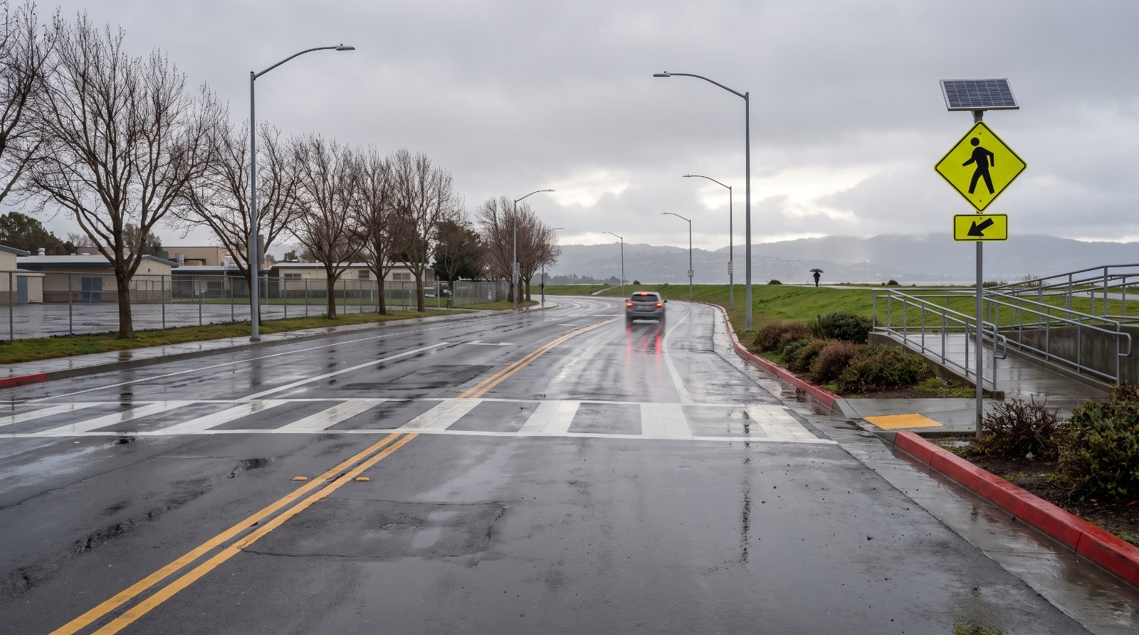
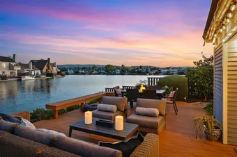
AI-rendered view of Beach Park Boulevard at Swordfish Street in Foster City after rain, looking north past the Bay Trail ramp Photo: Houseberry
Beach Park Boulevard along the bay in east Foster City is 62 feet from curb to curb. Four travel lanes, two parking strips, and green-backed sharrows painted in the lane to tell drivers that bikes belong there too. The city's new bike plan would take it down to three lanes, with a separated bikeway on the northbound side and a buffered one heading south.
That stretch, from Gull Avenue to Foster City Boulevard, is one of seven priority projects in Foster City's first Bicycle and Pedestrian Master Plan. The City Council adopted the plan on October 5, and the city filed its notice of exemption with the state on October 9.
Foster City has 29 miles of bike routes today and not one mile of protected lanes. The plan calls for 13.4.
This is a story about which streets change, and the answer is mostly the ones that lead to schools and the Bay Trail. The blocks around that Beach Park stretch are Bay Vista, which Houseberry scores 4.2 out of 5 for schools and 1.6 for nearby merchants, the lowest merchants score of Foster City's 11 neighborhoods. Nearly every errand from there is a trip.
Beach Park Boulevard loses a lane in both directions
Beach Park scored highest in the plan's ranking of 24 bike projects. Two of its segments tied for first at 8 points, on a scale that weighed crash history, traffic stress, school crossings and cost.
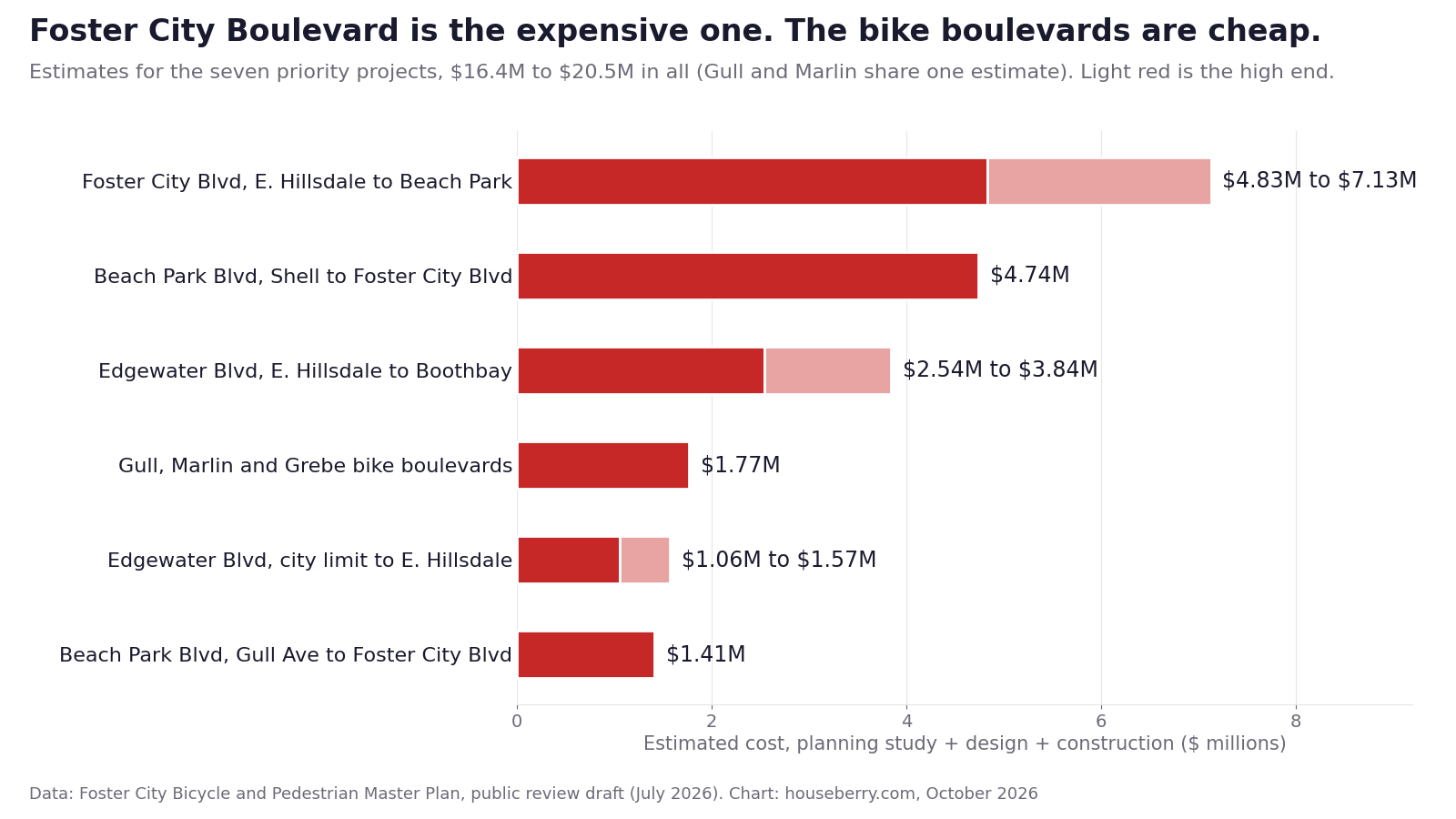
East of Foster City Boulevard, the boulevard runs between the houses and the levee. The design in the plan's public review draft narrows the lanes from 12 feet to 10, adds a center turn lane, and keeps parking on both sides. At the Bay Trail ramps it adds high-visibility crosswalks and raised refuge islands, and side streets like Teal and Egret get raised crosswalks and flashing beacons. Estimated cost: $1.41 million.
West of Foster City Boulevard to Shell, the change is bigger. That segment has two lanes each way split by a 16-foot median, and fewer than 2,500 cars a day by the city's count. The concept drops it to one lane each way with a 7-foot bike lane and a 5-foot buffer. It also costs more, about $4.74 million, and adds marked crossings with flashing beacons at Barkentine Street, Cutter Street and Wheel House Lane.
Not everyone on the council liked trading lanes for bikes. When the shortlist came up, Art Kiesel, the mayor at the time, said "losing a lane is, to me, a big deal," according to the San Mateo Daily Journal. Councilmember Phoebe Venkat answered from the other side. She would rather lose parking than other things. Both sides have a point on Foster City Boulevard, which drivers use to dodge Highway 92 when the bridge backs up. On Beach Park, with traffic counts this low, we do not think the extra lanes are doing much.
Start with Gull and Marlin
The cheapest package in the plan is also the one closest to the kids. Gull Avenue runs past Audubon Elementary at 841 Gull. Marlin Avenue runs a block from Bowditch Middle School on Tarpon Street, the only middle school in town. Grebe Street links the two.
These would be bike boulevards, where bikes share a calmed street with cars. Nothing gets removed. The lanes on Gull narrow from 12 feet to 10, parking stays, and speed cushions go in every 260 to 500 feet with gaps for buses and fire trucks. Crossings get high-visibility paint, curb extensions and, at the Gull midblock crossing, a raised refuge island and a flashing beacon.
That midblock crossing is the one parents brought up. In a focus group the city held with school PTA members in October 2025, parents said a crossing guard there "has been struck multiple times," and that nothing slows drivers between East Hillsdale Boulevard and the crosswalk.
All three streets together come to about $1.77 million. That is roughly a tenth of what the seven projects cost in total.
We think the city should build these first.
They reach Audubon and Bowditch for 9 to 11 percent of the money. Nobody gives up a lane or a parking space. And the July draft already marks them as candidates for quick-build paint and posts, which can go down before any concrete is poured.
Houseberry scores the two neighborhoods they cross the same on schools, 4.2 out of 5, and Carmel Village adds a 4.1 for amenities, and its typical home ran about $1.72 million in September 2026. Bay Vista's typical home was about $2.15 million that month, against $2.04 million for Foster City as a whole.
Which neighborhoods get a new bike street
Nine of Foster City's 11 scored neighborhoods sit on or next to at least one of the seven projects. Sea Colony, at the south end, and Vintage Park, the office district north of Highway 92, are the two without one. The table lines each one up with Houseberry's school, safety and amenities scores from the Foster City ranking and the typical home price from each neighborhood's 12-month price history.
| Neighborhood | Nearest priority project | School | Safety | Amenities | Typical home, Sept. 2026 |
|---|---|---|---|---|---|
| Bay Vista | Gull Ave bike boulevard, Beach Park (Gull to Foster City Blvd) | 4.2 | 2.5 | 3.5 | $2.15M |
| Carmel Village | Marlin Ave bike boulevard, Beach Park east | 4.2 | 2.9 | 4.1 | $1.72M |
| Marina Point | Marlin Ave, Beach Park (Shell to Foster City Blvd) | 4.2 | 2.1 | 3.9 | No recent history |
| Harbor Side | Beach Park (Shell to Foster City Blvd) | 4.3 | 3.4 | 3.7 | $1.32M |
| The Islands | Edgewater (E. Hillsdale to Boothbay) | 4.4 | 3.3 | 3.8 | $1.37M |
| Isle Cove | Edgewater (E. Hillsdale to Boothbay) | 4.5 | 1.7 | 3.6 | $1.53M |
| Dolphin Bay | Edgewater, ending at Boothbay Ave | 4.5 | 4.1 | 4.0 | $2.46M |
| Treasure Isle | Foster City Blvd | 4.5 | 2.5 | 3.8 | $1.54M |
| Metro Center | Edgewater, city limit to E. Hillsdale | 4.1 | 2.6 | 3.4 | $1.03M |
School scores barely move across the list, from 4.1 to 4.5. On the Foster City schools ranking, only Vintage Park, which gets no project, falls below 4. What does differ is how far people travel for daily needs. Bay Vista has the weakest merchants score in the city, and the Gull bike boulevard is its route north to East Hillsdale Boulevard and the shops in Metro Center.
The street that lines up first is Edgewater
The plan scores projects, but the cheapest time to restripe a street is when it is being repaved anyway. The draft compares each priority project with the city's five-year maintenance plan as of July 2026. One lines up: Edgewater Boulevard from the city limit to East Hillsdale, the six-lane stretch by Metro Center that feeds the Highway 92 ramps.
That segment would keep its six lanes and narrow them to 10.5 feet, with a 2-foot buffer beside each bike lane. It is one of the cheaper projects at $1.06 million to $1.57 million, and repaving is when a city can restripe a street for little more than the cost of paint.
Edgewater south of East Hillsdale is a harder sell. The posted limit is 40 miles per hour north of Beach Park, the plan suggests a lane cut is possible, and the separated bikeway section would remove on-street parking. The draft calls for a parking study before anyone decides. Foster City Boulevard, from East Hillsdale to Beach Park, is the most expensive line in the plan at $4.83 million to $7.13 million, and the high end includes two new traffic signals, at Marlin Avenue and at Beach Park. Both of those are flagged for grant applications rather than the city's own capital budget.
Who paid for the plan itself is simpler. The city's contract with Fehr & Peers was $130,000 plus a $20,000 contingency, and an $80,000 state Transportation Development Act grant covered half the budget.
What the October vote did and did not do
Adoption sets priorities. Money for each project still has to come from grants or the city's capital budget. The state exemption the city used covers bike and pedestrian plans, and the city's filing says each project still faces its own environmental review if it moves ahead. Every concept in the plan comes with a planning study, from $80,000 for northern Edgewater to $330,000 for Foster City Boulevard, before final design starts.
So if you live on Beach Park and you are worried about losing a lane, the next real chance to weigh in is the study for that segment, which comes with community engagement built into its budget. If you live on Gull and want the speed cushions, the same is true.
Seven projects and up to $20.5 million is a lot for a city of about 33,000 people. Gull and Marlin are $1.77 million of it, and they run past Audubon Elementary and the only middle school in town. Before the first of those studies, see how every Foster City neighborhood scores on our Foster City neighborhood ranking.
Sources
- CEQAnet, Notice of Exemption SCH 2026100273, Foster City Bicycle and Pedestrian Master Plan, received October 9, 2026
- Foster City Bicycle and Pedestrian Master Plan, public review draft, July 2026
- City of Foster City, Bicycle and Pedestrian Master Plan project page
- Foster City staff report, Fehr & Peers contract award, March 17, 2025
- San Mateo Daily Journal, Foster City prioritizes bike and pedestrian projects
The Houseberry Research Team is Houseberry's reporting team: Bay Area real estate analysts, data specialists and longtime local market watchers. Every day we check the public record: building permits, city council and planning agendas, county recorder filings, state housing bills, police incident data and school results. Then we tie each story to what it means for specific neighborhoods, using Houseberry's own neighborhood data on prices, appreciation, safety, schools and amenities. Questions or corrections: Contact us.
Map of Foster City Neighborhoods
Loading map...
View Full Map
Top Neighborhoods in Foster City, CA



All information provided on this website including but not limited to - school ratings, safety, amenities, user opinions, and property data - is for general informational purposes only. We do not guarantee its reliability, accuracy, or completeness. Users should independently verify information and consult appropriate professionals as needed. By using this website, you agree Houseberry is not responsible for actions, decisions, or consequences arising from reliance on the information provided
houseberry.com - CA DRE# 01847391
 Bay East ©2025. CCAR ©2025. bridgeMLS ©2025. Information Deemed Reliable But Not Guaranteed. This information is being provided by the Bay East MLS, or CCAR MLS, or bridgeMLS. The listings presented here may or may not be listed by the Broker/Agent operating this website. This information is intended for the personal use of consumers and may not be used for any purpose other than to identify prospective properties consumers may be interested in purchasing. Data last updated at October 13, 2026 12:00 AM