Election Day rain will soak Marin and barely touch San Jose
Up to three quarters of an inch falls in the North Bay hills Tuesday morning while San Jose gets a sprinkle. Here is when it hits and what to do first.

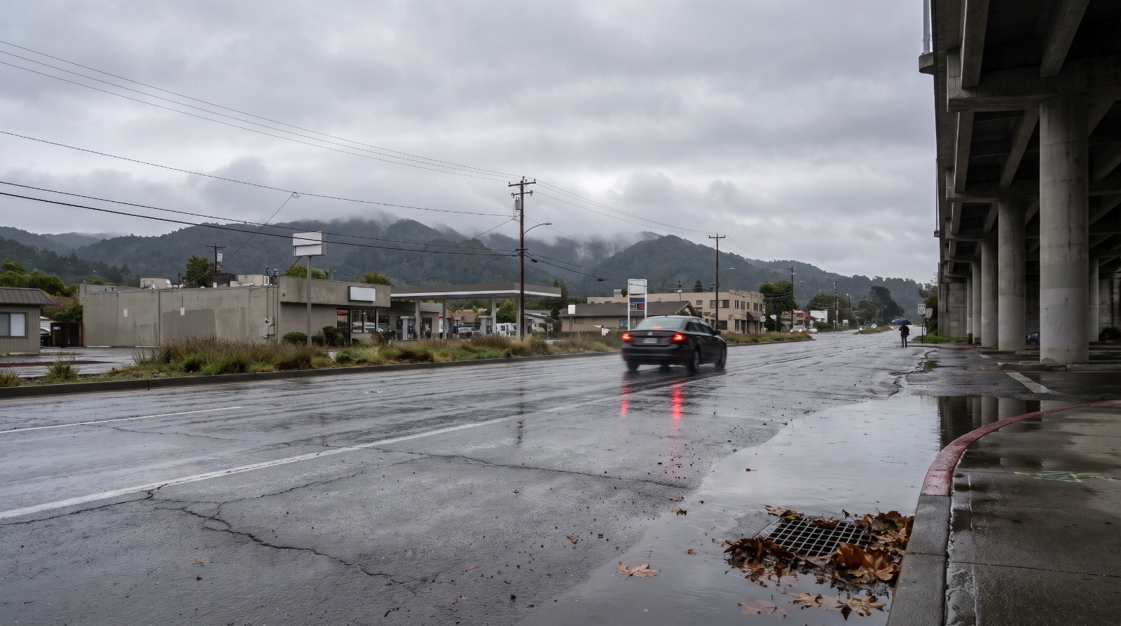
AI-rendered view of Shoreline Highway at Tam Junction in Mill Valley on a wet gray morning, with standing water at a storm drain and Mount Tamalpais in cloud Photo: Houseberry
The wettest place in the Bay Area on Election Day will be the hills between Sonoma and Marin. The National Weather Service's Monday afternoon forecast discussion, issued at 4:23 p.m. on November 2, gives the coastal North Bay mountains 0.5 to 0.75 inch of rain on Tuesday and most of San Francisco, the East Bay and the South Bay less than a tenth of an inch.
That top number is more than four times what San Francisco International Airport recorded in all of October. It lands on the morning commute, a few hours before the polls get busy, and on Marin neighborhoods that already sit low. By our count of Houseberry's FEMA flood map, 13 of the 53 Marin neighborhoods we mapped have at least a quarter of their land in the federal high-risk flood zone, and Tam Junction, ranked second of 55 in Houseberry's Marin ranking, is 92 percent inside it.
So the useful question for Tuesday, November 3, is small and local. Two chores are worth doing before 7 a.m.: clearing the storm drain in front of your house, and planning when your ballot goes into an official box so you are not standing in the heaviest hour of rain.
Who gets wet, and when
The rain comes in one main band on a cold front, then scattered showers behind it. The NWS Bay Area forecast discussion has the band reaching the coast around 5 to 6 a.m., the coastal North Bay by 7 to 8 a.m., and the rest of the region through the morning. Forecasters wrote that the heaviest rain will hit the morning commute and told drivers to slow down and expect slick roads.
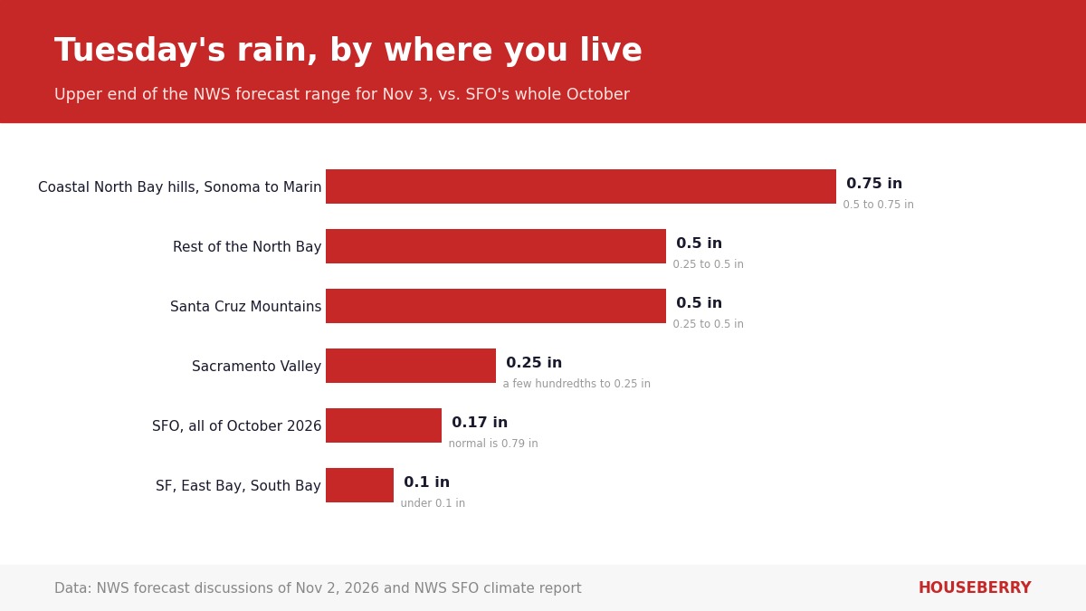
The city forecasts tell the same story at street level. The NWS point forecast for Santa Rosa, updated 2:35 p.m. Monday, calls for showers Tuesday with a 100 percent chance and a tenth to a quarter of an inch in town. San Jose's, updated at the same hour, gives a 60 percent chance, mostly before 11 a.m., and less than a tenth of an inch, with gusts to 18 mph.
Behind the main band, the forecast gives the coastal North Bay and the ocean a 15 to 20 percent chance of thunderstorms from late morning through late afternoon, and waterspouts are possible offshore. That depends on the sky clearing first. If it stays cloudy, the odds drop.
Stay off the beaches Tuesday. A Beach Hazards Statement runs through Tuesday evening for a long-period northwest swell that brings sneaker waves and strong rip currents.
Why the first wet commute is the slick one
October was dry. SFO recorded 0.17 inch for the month against a normal of 0.79, according to the NWS climate report for SFO issued November 1. That is about a fifth of a normal October.
Weeks of dry pavement collect oil and rubber, and the first real rain floats it to the surface before it washes away. A few tenths of an inch on Highway 101 through Marin at 7:30 a.m. is the classic setup. Leave early and leave room.
The drain in front of your house is the real test
We think Tuesday is a drain test. Half an inch of rain on an ordinary tide will not put Marin's flatlands underwater the way the nearly 8-foot king tides of October 26 to 30 did. It will show you which curb inlets on your block are packed with leaves, and that is the cheapest flooding problem a homeowner can fix.
Marin County Public Works' storm season checklist asks residents to clear leaves from driveway drains, roof gutters and street storm drains before a storm, to compost the leaves instead of sweeping them into the street, and to pull out rubber driveway ramps that block the gutter. Ten minutes with a rake Monday night is the whole job.
The tide helps this time. NOAA predicts San Francisco's Tuesday morning high at 5.33 feet at 7:21 a.m., and Point San Pedro off San Rafael at 5.39 feet at 8:23 a.m., per the NOAA tide predictions. San Francisco's figure is half a foot below the station's average higher high tide of 5.84 feet. Last Thursday, October 29, the San Francisco gauge read 8.05 feet, about 2.7 feet higher, and that was the day Shoreline Highway, Miller Avenue and Lucky Drive went underwater in our king tide roundup.
The low spots that flooded last week are the ones to watch for ponding Tuesday morning. Here they are with the share of each neighborhood that FEMA maps in its 1 percent annual chance flood zone, from our Bay Area flood zone analysis, and the Houseberry overall score. Corte Madera scores 4.3 out of 5 on Houseberry and had a typical home price of about $1.78 million in September 2026. South Larkspur scores 3.9 and sat at about $2.34 million that month. Marinship in Sausalito was about $845,000.
| Neighborhood | In FEMA 1% zone | Houseberry overall | Low spot that flooded last week |
|---|---|---|---|
| Tam Junction, Mill Valley | 92% | 4.6 | Shoreline Highway at the Manzanita park-and-ride |
| Marinship, Sausalito | 60% | 4.1 | US-101 ramps in north Sausalito |
| South Larkspur, Larkspur | 48.5% | 3.9 | Lucky Drive at the southbound 101 off-ramp |
| Corte Madera | 43.2% | 4.3 | Golden Hind Passage and Fifer Avenue |
| Downtown San Rafael | 28.1% | 2.9 | Southbound 101 off-ramp at Irwin Street |
All five flooded last week from bay water coming over the edge at a tide near 8 feet. On Tuesday they get rain on a 5.3-foot tide, which is a smaller problem. A clogged inlet can still make a puddle deep enough to stall a car at the bottom of an off-ramp, so drive around standing water you cannot see the bottom of.
Sacramento gets wind more than rain
The NWS Sacramento discussion issued 11:58 a.m. Monday expects a quick cold front Tuesday with "a few hundredths to a quarter of an inch" of rain, gusts of 20 to 35 mph that are strongest along the Sierra, and up to 2 inches of snow above 6,500 feet in the northern Sierra. It listed no advisories. Sacramento's airport logged 0.43 inch in October, per the NWS report issued Monday morning.
Gusts of 30 mph in early November strip the street trees, and that is how Sacramento's curb drains clog. If your block is one of the levee-protected neighborhoods in our Sacramento flood zone map, rain this light is no threat to the levees. A blocked inlet at your corner is the realistic problem, and the fix is the same rake.
Vote before the rain or after it
Polls are open from 7 a.m. to 8 p.m. on Tuesday, and November 3 is the last day to vote in person or return a ballot by 8 p.m., according to the Secretary of State. A mailed ballot still counts if it is postmarked by Election Day and arrives within seven days, but this late we would use an official drop box or a vote center.
Timing it is easy. In Marin and Sonoma, the dry window is Monday night or Tuesday afternoon, once the main band has moved through. In San Jose, the showers are forecast mostly before 11 a.m. Avoid the 7 to 9 a.m. hour everywhere north of the Golden Gate. That is when the heaviest rain meets the most cars.
Our pick for November 3: rake the drain tonight, drop the ballot after lunch, and check how your own block scores on the Marin neighborhood ranking while you wait out the shower.
Sources
- NWS San Francisco Bay Area, Area Forecast Discussion, 4:23 p.m. PST November 2, 2026
- NWS Sacramento, Area Forecast Discussion, 11:58 a.m. PST November 2, 2026
- NWS climate report for San Francisco International Airport, October 2026
- NOAA tide predictions, San Francisco station 9414290
- California Secretary of State, November 3, 2026 General Election
- Marin County Public Works, storm season prep
The Houseberry Research Team is Houseberry's reporting team: Bay Area real estate analysts, data specialists and longtime local market watchers. Every day we check the public record: building permits, city council and planning agendas, county recorder filings, state housing bills, police incident data and school results. Then we tie each story to what it means for specific neighborhoods, using Houseberry's own neighborhood data on prices, appreciation, safety, schools and amenities. Questions or corrections: Contact us.
Map of Marin Neighborhoods
Loading map...
View Full Map
Top Neighborhoods in Marin, CA





All information provided on this website including but not limited to - school ratings, safety, amenities, user opinions, and property data - is for general informational purposes only. We do not guarantee its reliability, accuracy, or completeness. Users should independently verify information and consult appropriate professionals as needed. By using this website, you agree Houseberry is not responsible for actions, decisions, or consequences arising from reliance on the information provided
houseberry.com - CA DRE# 01847391
 Bay East ©2025. CCAR ©2025. bridgeMLS ©2025. Information Deemed Reliable But Not Guaranteed. This information is being provided by the Bay East MLS, or CCAR MLS, or bridgeMLS. The listings presented here may or may not be listed by the Broker/Agent operating this website. This information is intended for the personal use of consumers and may not be used for any purpose other than to identify prospective properties consumers may be interested in purchasing. Data last updated at November 3, 2026 12:00 AM